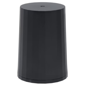
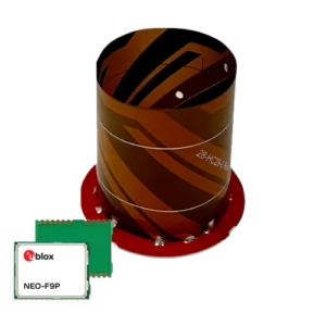
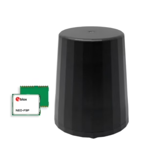
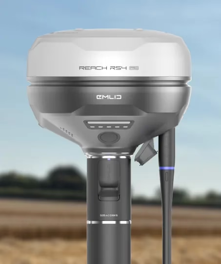
Emlid Reach RS4 Pro – All‑Band RTK GNSS with Dual Cameras & Visual Stakeout (UK)

£3,582.50 Each EXVAT (EXW)

Emlid Reach RS4 Pro – Advanced RTK GNSS Receiver

Precision GNSS Made Faster, Smarter, Safer

All‑band RTK GNSS receiver with dual cameras for visual stakeout and remote point capture—designed to speed up workflows and improve safety in the field.

  • All‑Band RTK Accuracy – Reliable positioning across all major GNSS constellations.
  • Dual Cameras – Visual stakeout and remote point capture for effortless surveying.
  • Built for Speed & Safety – Work faster on‑site with reduced exposure to hazards.
  • Pro‑Grade Durability – Rugged design for demanding environments.

In-Stock UK – most orders ship within one working day.

Authorised UK Emlid Dealer since 2018. UK Support within two hours.

The Emlid Reach RS4 Pro sets a new benchmark in precision surveying with its all-band RTK GNSS technology and dual-camera system, enabling visual stakeout and remote point capture for faster, safer workflows. As an official Emlid dealer since 2018, Innovelec combines extensive product knowledge with trusted UK-based support, ensuring customers receive not only cutting-edge equipment but also expert guidance and service to maximise performance in the field.

Key Features

  • All-Band RTK GNSS Receiver – Supports GPS, GLONASS, Galileo and BeiDou for maximum coverage and accuracy.
  • Dual Cameras – Enables visual stakeout and remote point capture for safer, more efficient operations.
  • Visual Stakeout Workflow – Simplifies complex tasks with intuitive visual guidance.
  • Remote Point Capture – Collect points without physically accessing hazardous or hard-to-reach areas.
  • Fast Initialisation & High Accuracy – Achieve centimetre-level precision quickly in challenging environments.
  • Robust Design – Built for demanding field conditions with IP67-rated durability.
  • Seamless Integration – Works with Emlid Flow and other industry-standard software for smooth workflows.

Experience the Reach RS4 Pro — a new standard in surveying.

Equipped with dual Full HD cameras, the RS4 Pro pushes surveying and stakeout capabilities beyond what conventional RTK systems can offer.

Bring speed and clarity to stakeout with AR‑enhanced guidance

The RS4 Pro transforms stakeout into a highly visual workflow. Instead of working from numbers alone, your project layout is projected directly onto the surrounding environment, making it easy to see exactly where each stake needs to be set.

Mechanical


  • Dimensions: 128.6 × 128.6 × 99.3 mm
  • Weight: 920 g
  • Operating temperature: −40 °C to +65 °C
  • Ingress protection: IP68

Electrical


  • Autonomy: Up to 16 hrs as RTK rover with tilt
  • Battery: Li‑Ion 5000 mAh, 7.2 V (36 Wh)
  • Charging: USB Type‑C (PD)
    • 5V — 3A
    • 9V — 3A
    • 12V — 3A
    • 15V — 3A

Positioning

  • Static:
    • Horizontal: 4 mm + 0.5 ppm
    • Vertical: 8 mm + 1 ppm
  • PPK:
    • Horizontal: 5 mm + 0.5 ppm
    • Vertical: 10 mm + 1 ppm
  • RTK:
    • Horizontal: 7 mm + 1 ppm
    • Vertical: 14 mm + 1 ppm
  • Tilt compensation: RTK + 2 mm + 0.3 mm/°
  • Convergence time: ~5 s typically

Connectivity


  • LoRa radio:
    • Power: up to 1 W
    • Frequency: 868/915 MHz
    • Range: up to 8 km
  • UHF radio:
    • Power: up to 2 W
    • Frequency: 410–470 MHz
    • Protocols: TRIMTALK 450S
    • Modulation: GMSK
  • LTE modem:
    • Regions: Global
    • Bands:
      • FDD‑LTE: 1, 2, 3, 4, 5, 7, 8, 12, 13, 18, 19, 20, 26, 28
      • TD‑LTE: 38, 39, 40, 41
    • UMTS: 1, 2, 5, 8
    • GSM: Quad‑band (850/1900, 900/1800 MHz)
  • SIM card: Nano‑SIM
  • Wi‑Fi: 802.11 a/b/g/n
  • Bluetooth: 5.1 (BR/EDR + LE)
  • Ports: RS‑232, USB Type‑C

Data


  • Corrections: NTRIP, RTCM3
  • Position output: NMEA, LLH/XYZ
  • Data logging: RINEX, NMEA, LLH/XYZ, UBX
  • Internal storage: 16 GB

Imaging


  • Image sensors: 1/2.6 in CMOS, global shutter, Full HD
  • Field of view:
    • Front camera: H 64.6°, V 42.8°
    • Bottom camera: H 63°, V 42°
  • Video frame rate: 25 fps

GNSS


  • Signals tracked:
    • GPS: L1C/A, L2C, L5
    • GLONASS: L1OF, L2OF
    • Galileo: E1‑B/C, E5a, E6
    • BeiDou: B1I, B1C, B2a, B3I
    • QZSS: L1C/A, L1C/B11, L2C, L5
    • NavIC: L1‑SPS, L5‑SPS
  • Number of channels: 672
  • Update rates: up to 10 Hz